Shared:Routing and Visualising Info
Routing & Visualising Information
Routing and Visualizing Information is about combining the strengths of two projects mainly based on the routing of people using the NDSM-area. The aim is to interweave the two projects even further and make them benefit from each other. This will result in a meltdown of the key elements of the projects in a physical and virtual way; a routing-system which let people discover NDSM as they never did! Connection. The Lightscape and The Ondina Pavilion will be both physically and virtually connected to each other. The ribbon will constitute a part of the pavilion's structure - the boulevard continues over the pavilions inner space and becomes the roof.- The structure of the pavilion reflects an network as congregation of all different routes over NDSM and will be projected over the main shape of the pavilion. The dimensions of this network are based on ; -the location of the boulevard over the pavilion -direction of sunlight -entrances of pavilion TEXT LIGHTSCAPE PHYSICAL....
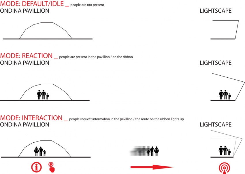
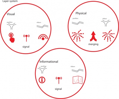
In the virtual way, the two projects together deliver an interactive system, providing the visitors a direction over the NDSM area from the starting point near the ferry platform to other 'snap points'. The Lightscape will be connected to the visual and physical content of the Ondina pavilion, allowing visitors to change the image of the NDSM's lighting ribbon for a short time by demanding their route over NDSM. These connections to other snap points are present within three different layers and modes described below.

